What do flats rent and sell for in each district and neighbourhood?
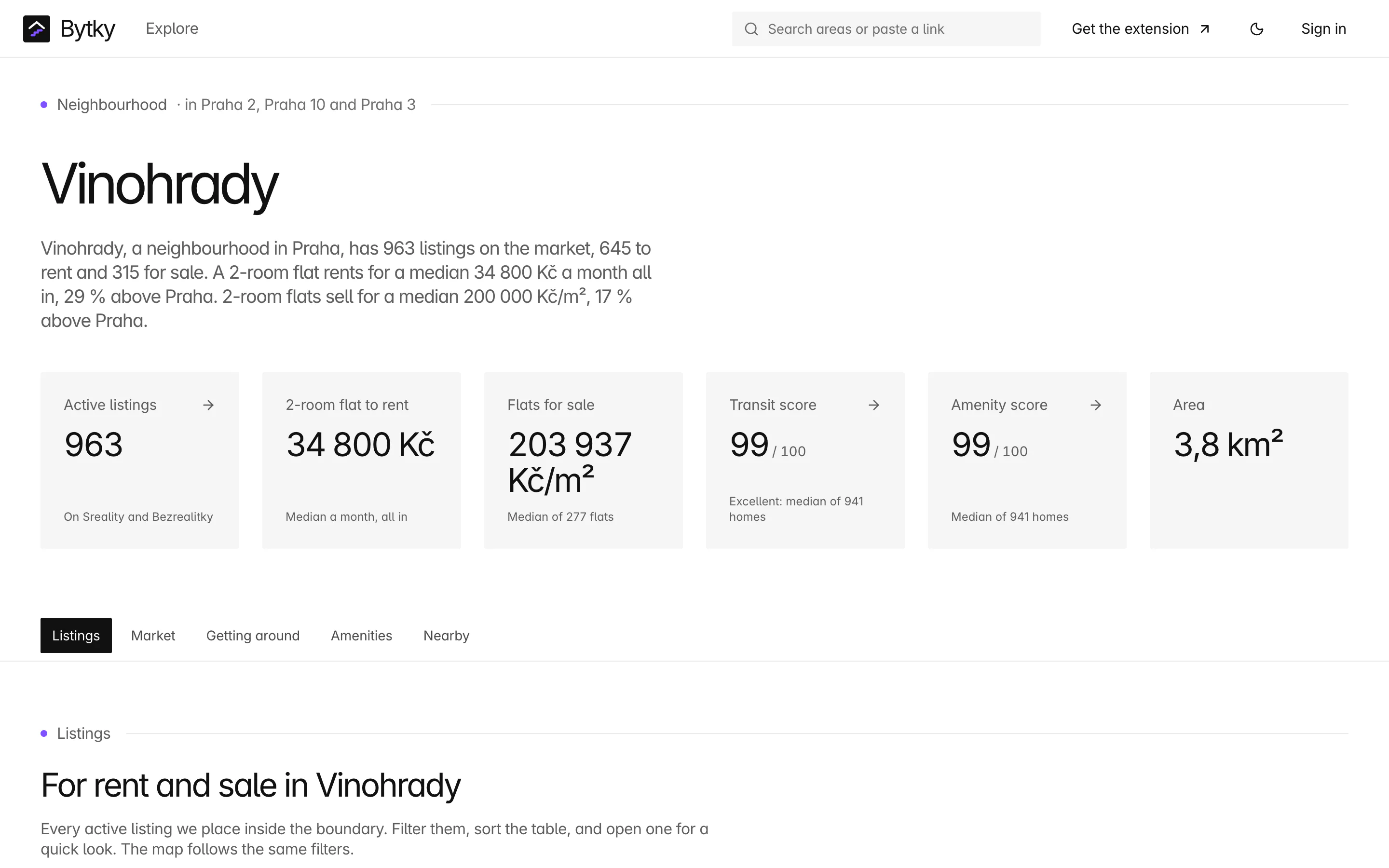
Every region, district, municipality and municipal part in Czechia has its own Bytky page, and so do 231 neighbourhoods in eight cities, such as Holešovice, Karlín and Vinohrady in Prague. Each shows median rent and price per m² for every kind of property against the wider area, every active listing on a map and in a table, how long it takes to get around and what's nearby. Search for an area by name to start.
Updated
Which areas have a page?
Every level of the state's address register, RÚIAN, from the top down: regions (kraje), districts (okresy), municipalities and their parts. In Prague the parts are Praha 1 to Praha 22 and the other municipal districts.
Prague's districts aren't the names people use, so Bytky adds neighbourhoods: the cadastral areas, such as Holešovice, Karlín, Vinohrady, Žižkov and Libeň, in the eight cities split into districts. There are 231 of them: 80 in Prague, 29 in Brno, 26 in Ústí nad Labem, 25 in Liberec, 24 in Ostrava, 19 in Pardubice, 18 in Plzeň and 10 in Opava. A neighbourhood can span several districts: Vinohrady lies in Praha 2, 3 and 10, and its page says so.
What does the market section show?
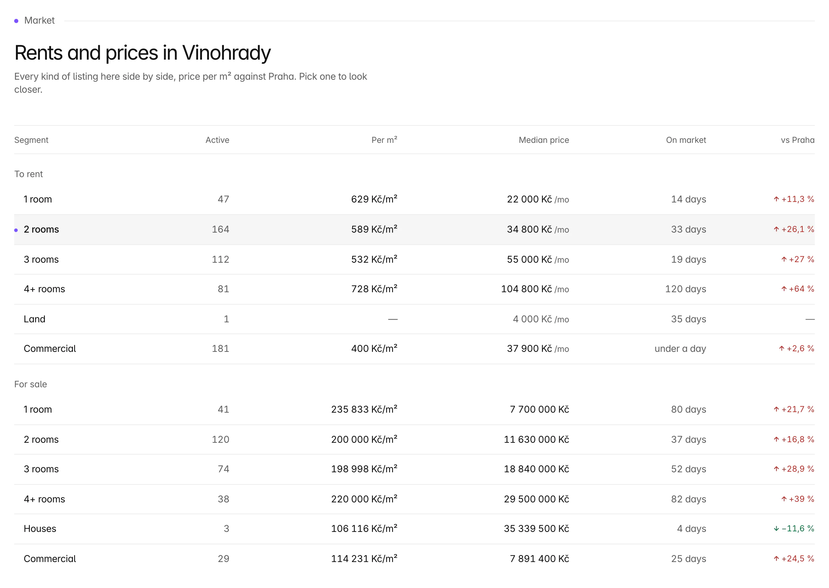
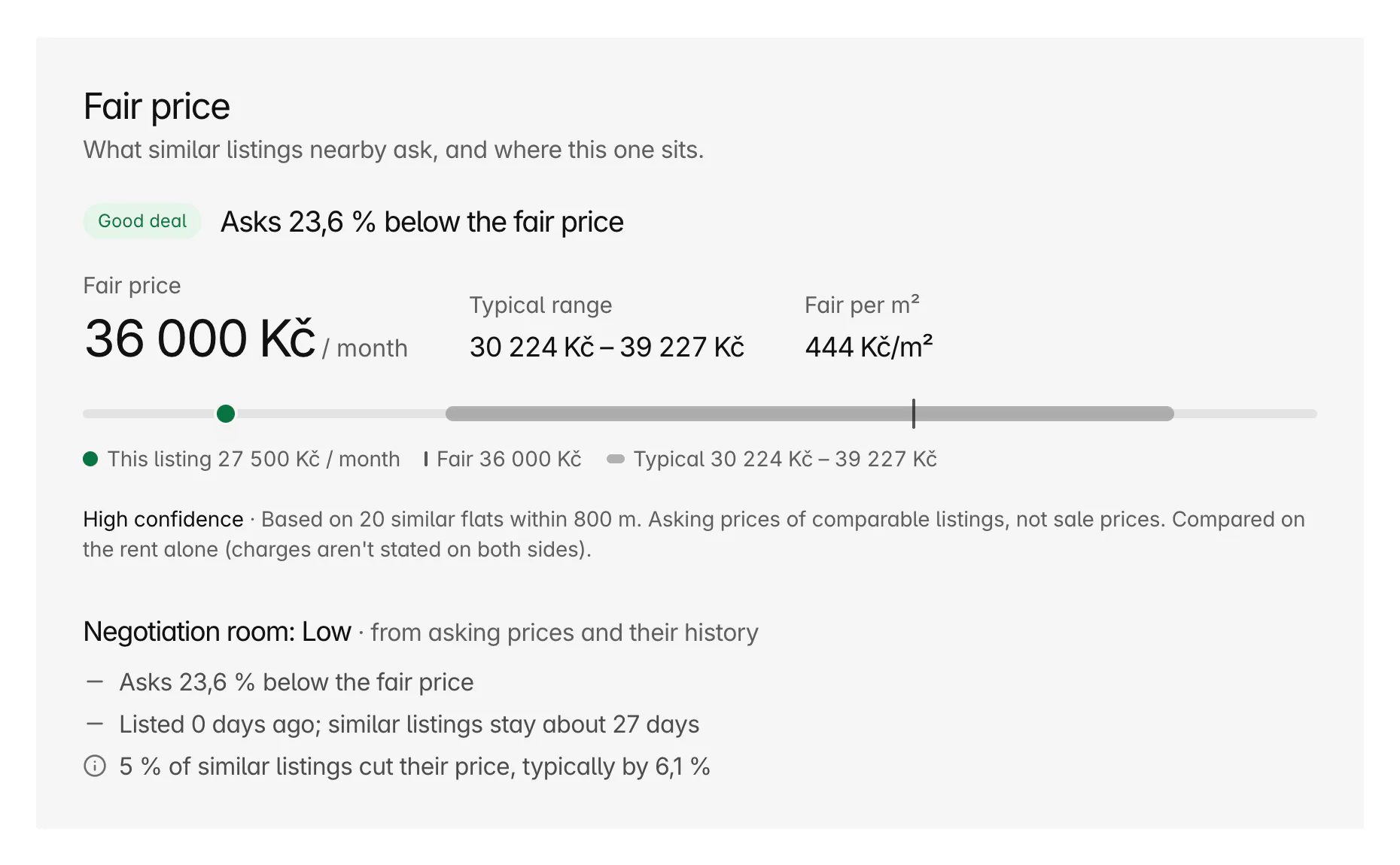
A written summary at the top of the page, then a table of every kind of listing in the area side by side: to rent and for sale, by number of rooms, then houses, land and commercial property. Each row has the number of active listings, the median price per m², the median price, the median time on the market and the difference from the wider area. Pick a row to look closer.
How are the area figures worked out?
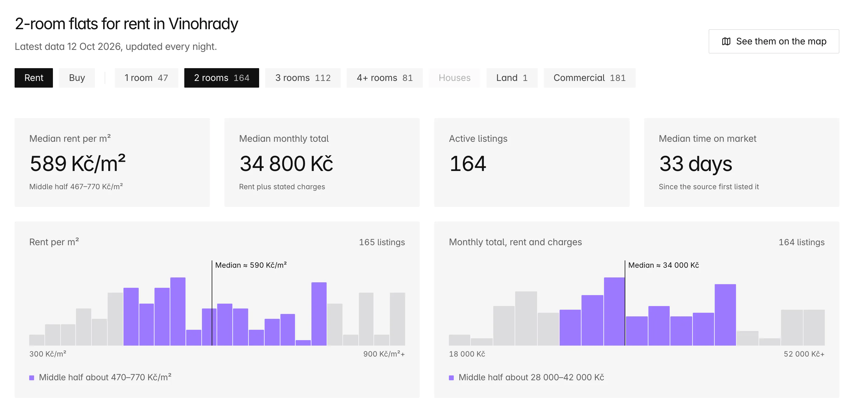
From the active listings Bytky places inside the area's boundary, by its own location check rather than the site's label. For the kind of listing you pick, the page shows the median price per m² with its middle half, the median monthly total (rent plus stated charges), the number of active listings and the median time on the market, with histograms of how the prices spread. Medians from fewer than 3 listings are never quoted.
Each area is compared with the nearest wider area that holds other listings, a part with its city and a city with its region, and neighbouring areas are ranked by how much cheaper or dearer they are. The figures update every night, the trend lines grow a day at a time, and a ‘Right now’ row shows the best deals and the biggest price cuts.
Can I see every listing in an area?
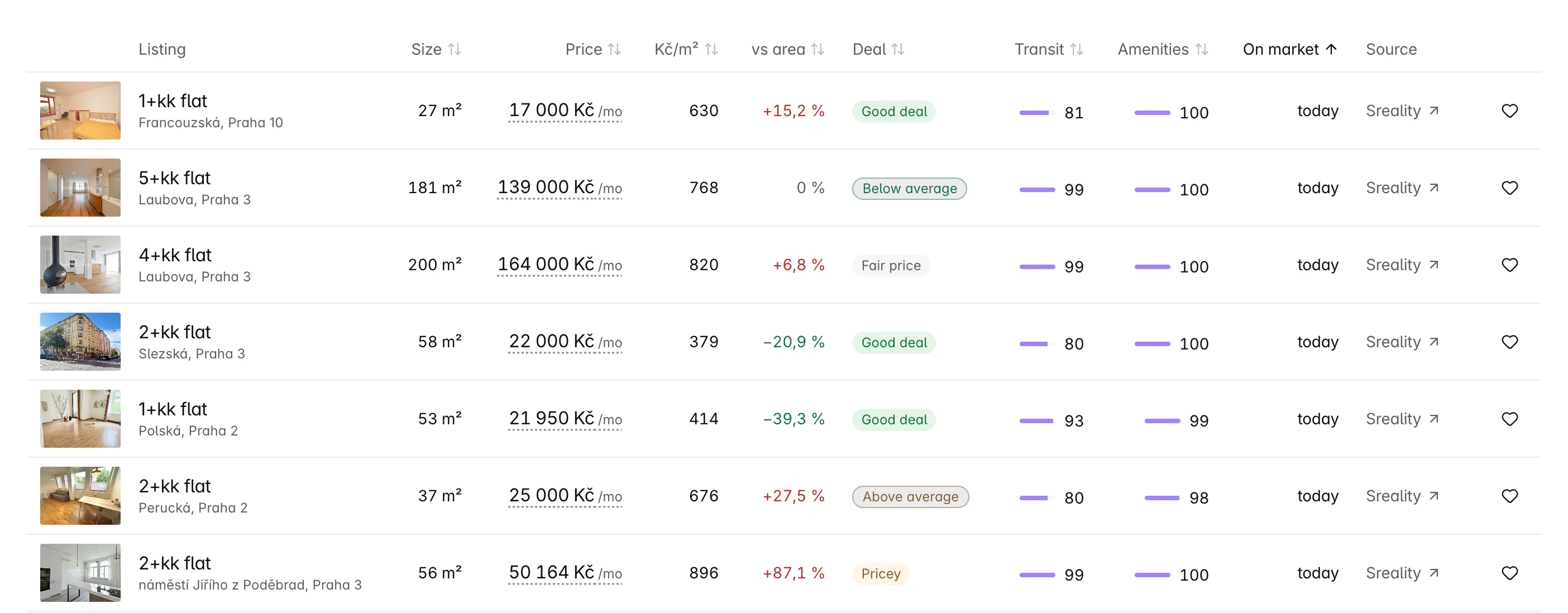
Yes. The page opens on a full-width map of the area, its boundary drawn and everything outside dimmed, with every active listing pinned and coloured by its good-value verdict and the explorer's Places, Transit and reach layers. Below it, a table lists every listing, 50 to a page, and sorts by size, price, price per m², the difference from the area, transit and amenity scores or time on the market.
- Filters shared by the map and the table: rent or buy, type, layout, price, size, new this week, price cut, good deals and photos.
- ‘Only in map view’ narrows the table to what the map shows.
- With a free account, download the filtered table, up to 1,000 rows, for Excel or as a CSV, with a link to every listing.
- ‘Alert me about new listings here’ saves the area and its filters as a search.
How connected is the area, and what's nearby?
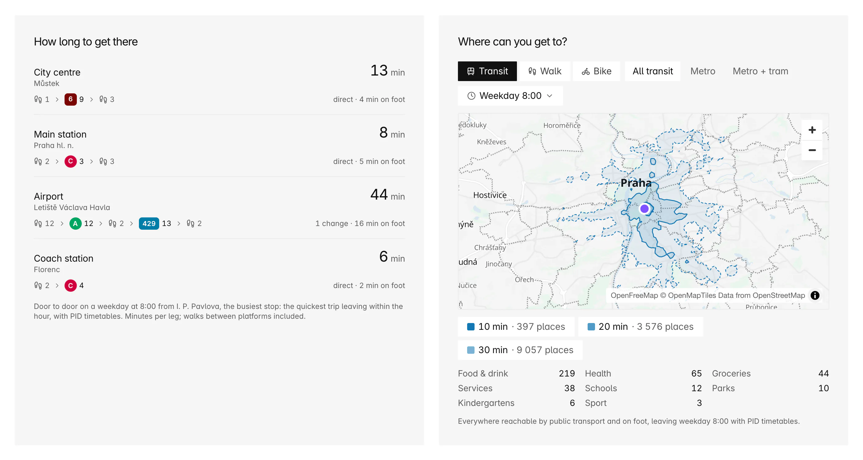
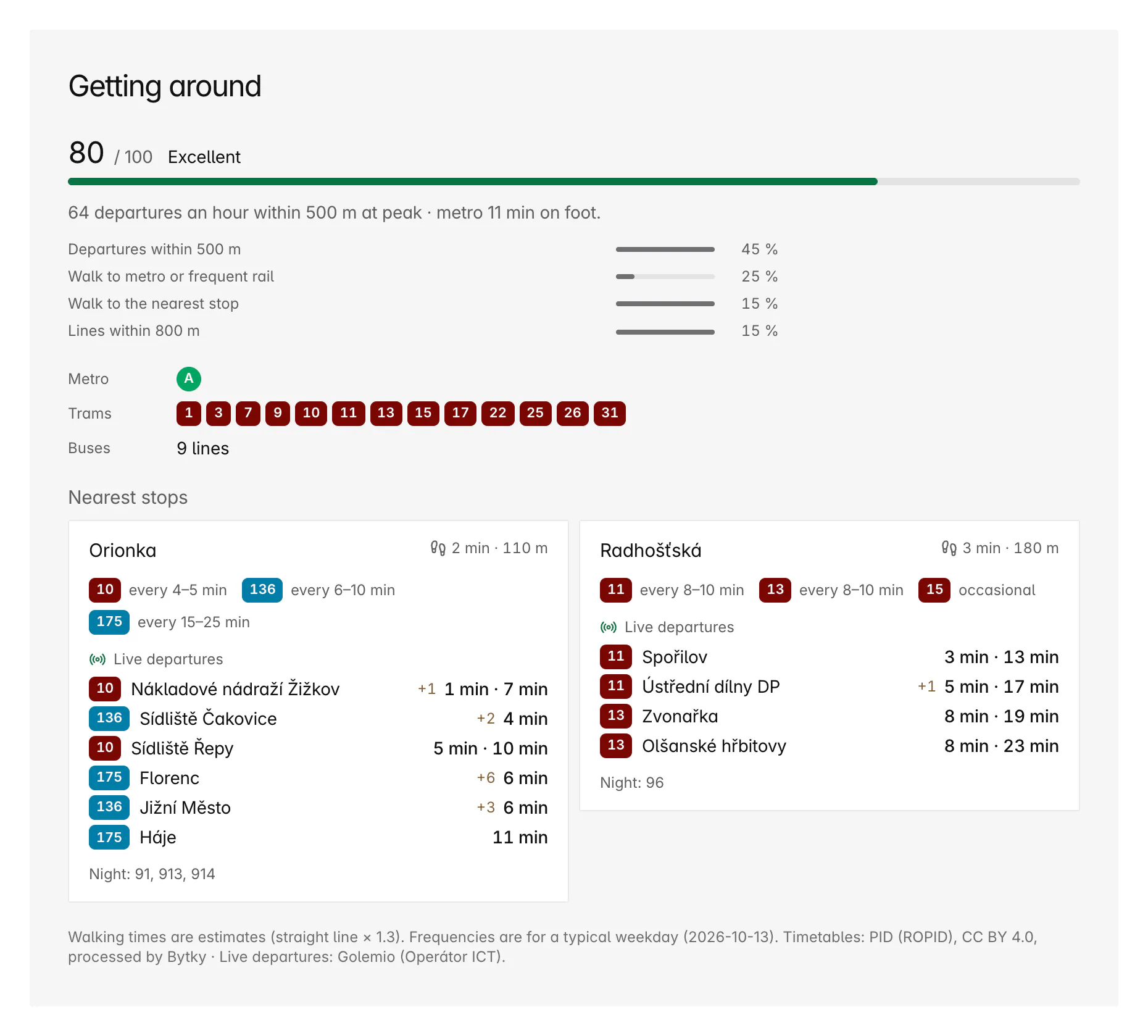
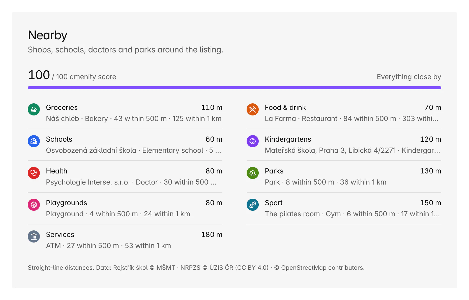
In the PID area, a Getting around section counts the area's stops and lines, measures how much of it lies within a short walk of a stop or a metro station, and times the trip from its busiest stop to the centre, the main station, the airport and Florenc, with a reach map beside it. An Amenities section counts the shops, schools, doctors and parks and compares them with the wider area.
Coverage and limits
Where does it work, and where does it stop?
Area pages cover the whole of Czechia.
- Asking prices, not transaction prices: a median rent is what listings ask.
- Market history began on 12 October 2026, so the trend lines are short and grow daily.
- Medians from fewer than 3 listings aren't quoted, so small villages often show counts but no prices.
- Getting around and travel times cover the PID area only.
- Neighbourhoods exist in the eight cities split into districts; elsewhere the cadastral areas already are the municipal parts.
- The headline figures are refreshed hourly, so the count at the top can lag the live table.
- The download needs a free account and stops at 1,000 rows.
Boundaries and addresses: © ČÚZK (RÚIAN), CC BY 4.0 · Listings: Sreality.cz and Bezrealitky.cz, read from their public pages
FAQ
Frequent questions
More about Bytky as a whole, from what it costs to where the data comes from.
Read the main FAQWhat is the average rent in a Prague neighbourhood?
Each area page shows the median for every kind of flat. On 12 October 2026, a 2-room flat in Vinohrady asked a median 34,800 Kč a month including charges, or 589 Kč per m², across 164 listings. Open any area page for today's figures and how they compare with the rest of Prague.
What's the difference between the Praha 7 and Holešovice pages?
Praha 7 is an administrative district; Holešovice is a neighbourhood, a cadastral area, that lies mostly inside it. Praha 7's page lists the neighbourhoods within it, and each neighbourhood's page names the districts it spans.
How often are area pages updated?
The market figures are recalculated every night. The map and the listings table are live, and the headline figures are refreshed every hour.
Can I download an area's listings?
Yes, with a free account: the table's download saves the filtered listings, up to 1,000 rows, as an Excel file or a CSV, each with a link to the original listing.
Why does a village show no median price?
Because Bytky never quotes a median from fewer than 3 listings. The page still shows how many listings there are, the map and everything nearby.
Related features
Where to go next
Know what a flat is worth before you call.
Free for flat hunters. No install and no account to start.