How well connected is a flat to public transport?
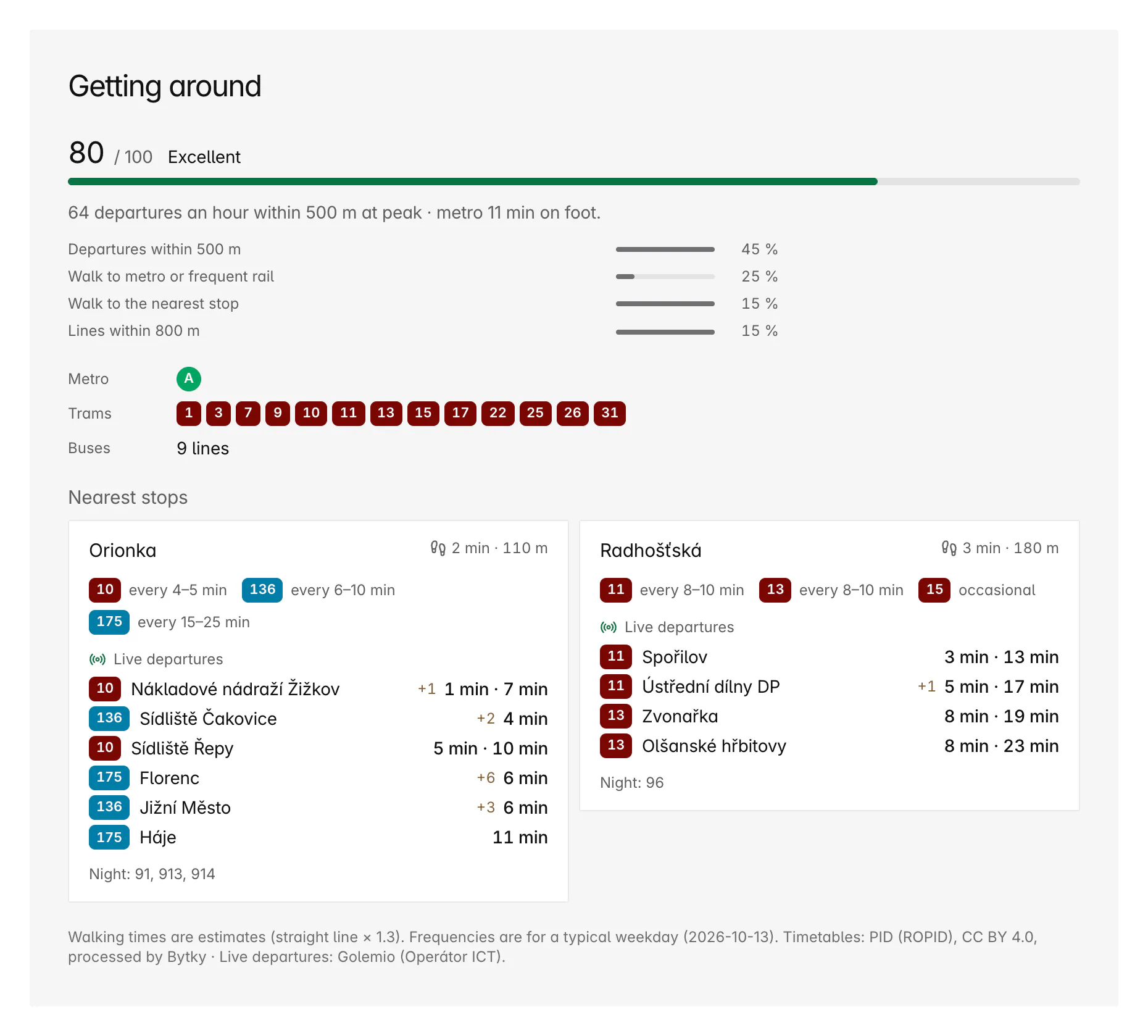
Every listing in Prague and Central Bohemia gets a transit score from 0 to 100, built from the PID timetables: how many departures leave within 500 m at the morning peak, the walk to the nearest metro or frequent train, the walk to the nearest stop and how many lines run within 800 m. The listing's Getting around section adds the lines, how often they run and live departures. Filter the map by a minimum score to start.
Updated
How is the transit score calculated?
From four parts, each scored from 0 to 1 and weighted:
- Departures, 45%: the departures an hour at the weekday morning peak (7:00 to 9:00) of every line stopping within 500 m, each line counted once at its busiest stop. Full marks at 60 an hour, on a log scale, so going from 5 to 20 an hour counts for more than going from 40 to 55.
- Rapid transit, 25%: the walk to the nearest metro station, or rail stop with at least two trains an hour at peak. Full marks within about 5 minutes on foot.
- Nearest stop, 15%: the walk to the nearest stop with daytime service. Full marks within about 200 m as the crow flies.
- Lines, 15%: how many daytime lines stop within 800 m. Full marks at 12.
Night lines don't count; they're listed separately. The card shows each part, so you can see whether a flat scores on frequency or on a nearby metro station, and names the band: Excellent from 80, Very good from 65, Good from 50, Fair from 30, otherwise Limited.
What does the Getting around section show?
Everything you'd otherwise look up in a journey planner:
- The score and its four parts.
- Every daytime line within 800 m by mode, from metro and tram to bus, train, ferry and cable car, as badges in PID colours.
- The nearest stops, with the walk to each, the lines that call there and how often they run, such as ‘every 4–5 min’.
- Live departures from those stops, with any delay.
- The night lines that call nearby.
Where does the timetable data come from?
From PID, Prague Integrated Transport, which publishes its timetables as open data every day. Bytky checks the feed every six hours and imports it when it changes; the import on 13 October 2026 held 7,959 stops with regular service. Live departures come from Golemio, Prague's data platform, run by Operátor ICT.
How do I find well-connected flats on the map?
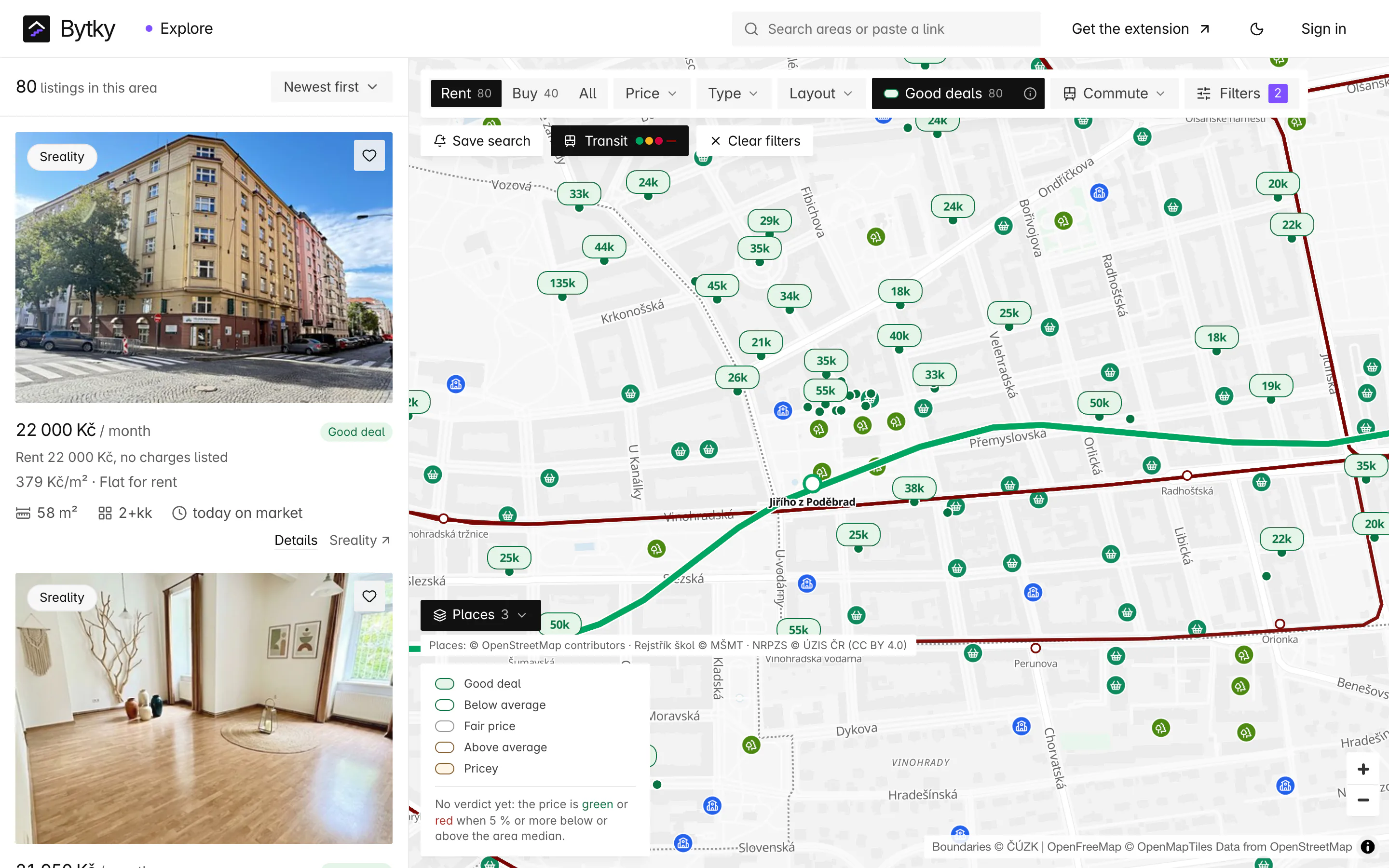
Turn on the Transit layer to draw metro lines A, B and C in their colours, the tram network and, closer in, every stop. Set a minimum transit score in the filters to keep only flats at or above it. Area pages sort their listings by score too.
How well connected is a whole area?
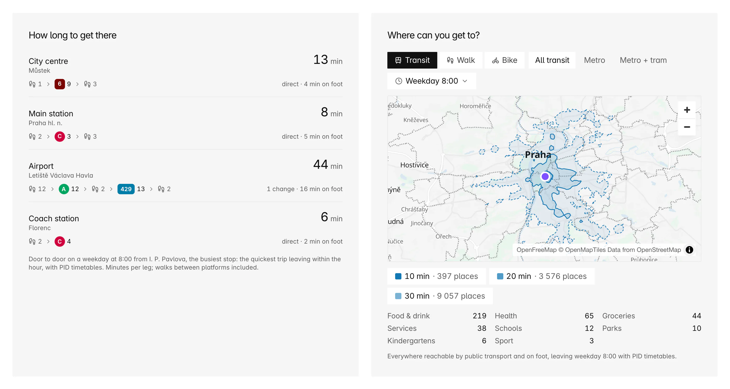
Every area page in the PID area has a Getting around section: its stops by mode, its lines, peak departures, the share of the area within 500 m of a stop and within 800 m of a metro station or train stop, and its busiest stops. It also times the trip from the area's busiest stop to the city centre (Můstek), the main station, the airport and Florenc coach station, leaving at 8:00 on a weekday. From Vinohrady that's 13, 8, 44 and 6 minutes.
Coverage and limits
Where does it work, and where does it stop?
Transit data covers the PID network.
- Prague and Central Bohemia only: a listing counts as inside when a PID stop lies within 3 km. Elsewhere the section is hidden rather than showing zeros.
- Walking times to stops are estimates: the straight line plus 30%, at 80 m a minute.
- Frequencies describe a typical weekday; evenings, weekends and holidays run less often.
- Live departures depend on Golemio. When it's unavailable, the section shows frequencies only.
- A score can't judge comfort, crowding or step-free access.
Timetables: PID (ROPID), CC BY 4.0 · Live departures: Golemio (Operátor ICT)
FAQ
Frequent questions
More about Bytky as a whole, from what it costs to where the data comes from.
Read the main FAQWhat is a good transit score?
The card calls 80 and above Excellent, 65 Very good, 50 Good and 30 Fair. Full marks need around 60 departures an hour within 500 m, a metro station within about 5 minutes on foot, a stop within 200 m and 12 lines within 800 m.
Do night trams count towards the score?
No. The score uses daytime lines only, so a stop served just at night doesn't lift it. Night lines are listed separately on the card.
Are the walking times to stops exact?
No, they're estimates: the straight-line distance plus 30% for the street layout, at 80 m a minute. They're good for comparing flats but can be off where a river, a railway or a park is in the way.
Are the departures live?
Yes. They come from Golemio, Prague's data platform, with any delay shown, and are usually less than 30 seconds old.
Why doesn't a flat outside Prague have a transit score?
Transit scores need the PID timetables, which cover Prague and Central Bohemia. A listing counts as inside when a PID stop lies within 3 km; elsewhere the section is left out.
Related features
Where to go next
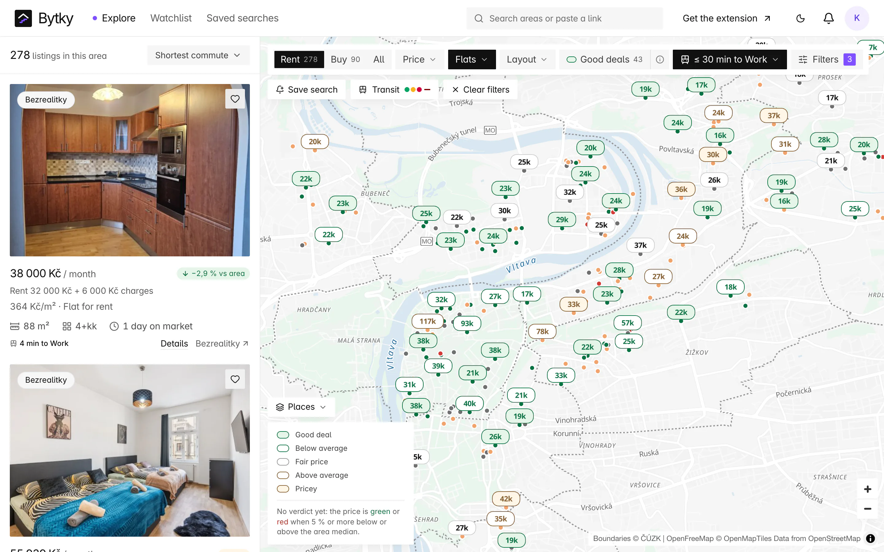

Know what a flat is worth before you call.
Free for flat hunters. No install and no account to start.