Where can I get to in 30 minutes from a flat?
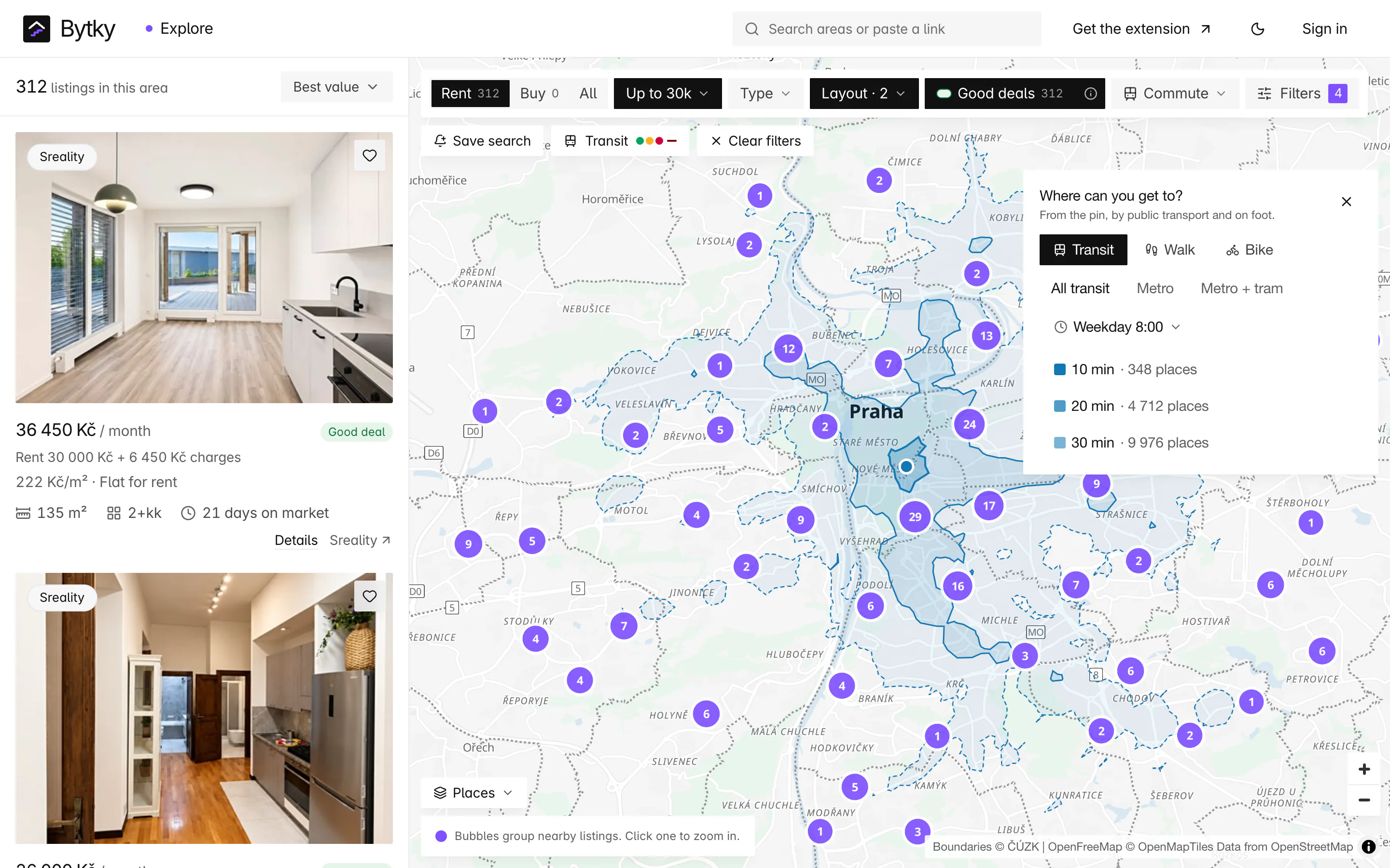
From any listing, area page or point you right-click on the map, Bytky draws everywhere you can reach in 10, 20 and 30 minutes by public transport, on foot or by bike, leaving when you would. Each band counts the shops, schools, doctors, parks and other places inside it. It covers Prague and Central Bohemia: open a listing's ‘Where can you get to?’ section, or right-click the explorer map, to start.
Updated
How is the reach map drawn?
Bytky asks OpenTripPlanner, running on the PID timetables and the OpenStreetMap street network, how far you can get from the point in 10, 20 and 30 minutes, leaving at the time you pick. By public transport that includes the walk to the stop, the wait, the ride, any change and the walk at the other end. The answer comes back as three nested outlines, called isochrones: the darkest band is 10 minutes, the palest 30.
Public transport reach isn't a circle. It runs out along metro and tram lines and leaves islands around stations further out, which is why the 30-minute band often looks patchy: the islands are places you can reach in time, with gaps between them that you can't.
Which ways of getting around can I choose?
Three ways, and four departure times:
- Transit: all of PID, metro only, or metro and tram, each with the walking in between.
- Walk and Bike: along the street network.
- Leaving weekday 8:00, weekday 17:30, Saturday 10:00 or weekday 22:30. Weekdays skip public holidays, so the timetable is a normal working day's.
The choice matters. From Vinohrady, the 30-minute band held 7,091 places by all public transport, 6,855 by metro and tram and 6,092 by metro alone when those options were added in October 2026.
What do the place counts tell me?
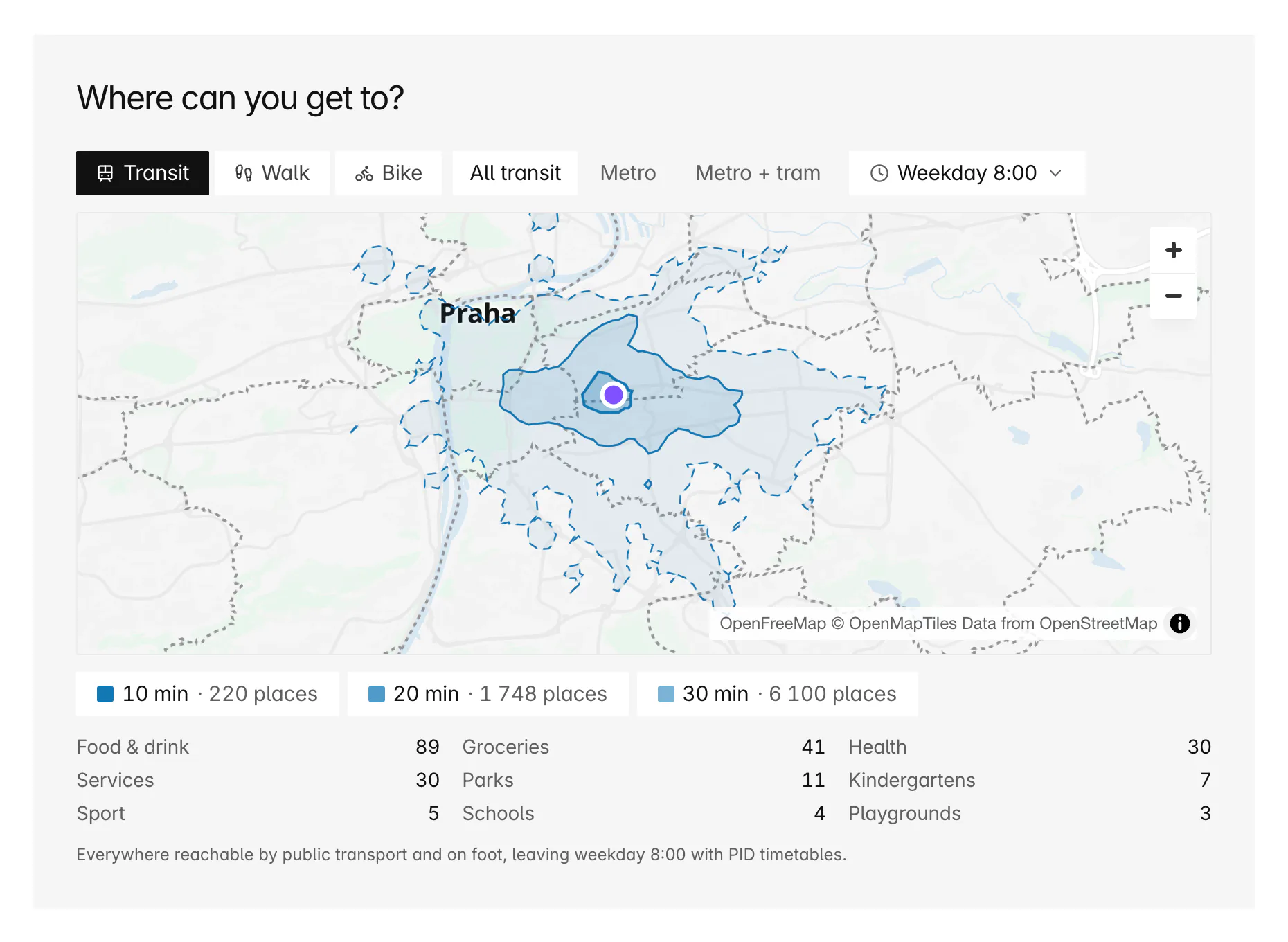
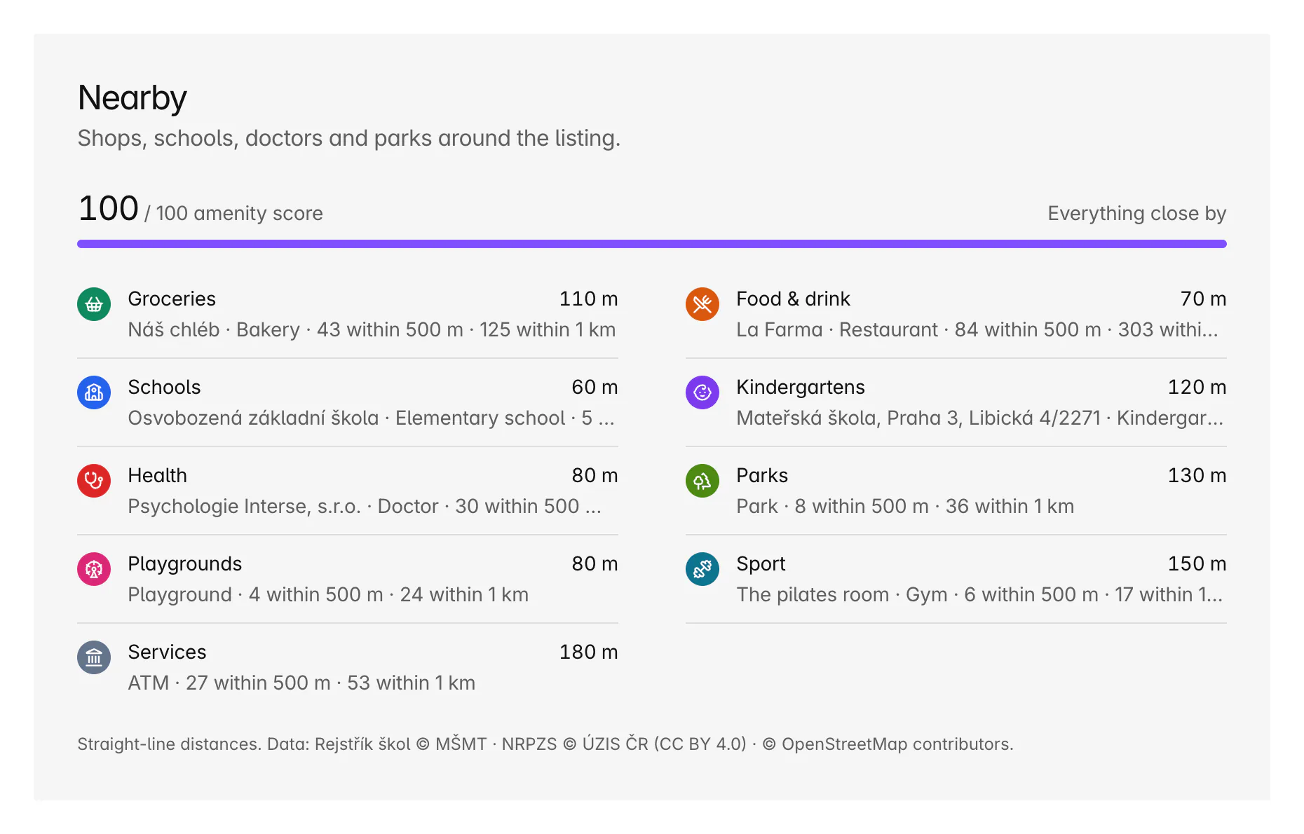
How much of daily life each band puts within reach. Every band counts the places inside it from the same open data as the Nearby section: groceries, food and drink, schools, kindergartens, health, parks, playgrounds, sport and services such as post offices and cash machines. The counts are worked out in the database for each band, so they cover every place, not a sample.
They turn ‘well connected’ into numbers you can compare. Two flats at the same rent can put very different amounts within 20 minutes: open both and compare their bands.
Where can I open a reach map?
In four places:
- On every listing page and in the map's side panel, under ‘Where can you get to?’.
- Anywhere on the explorer map: right-click, or long-press on a phone, and clear it when you're done.
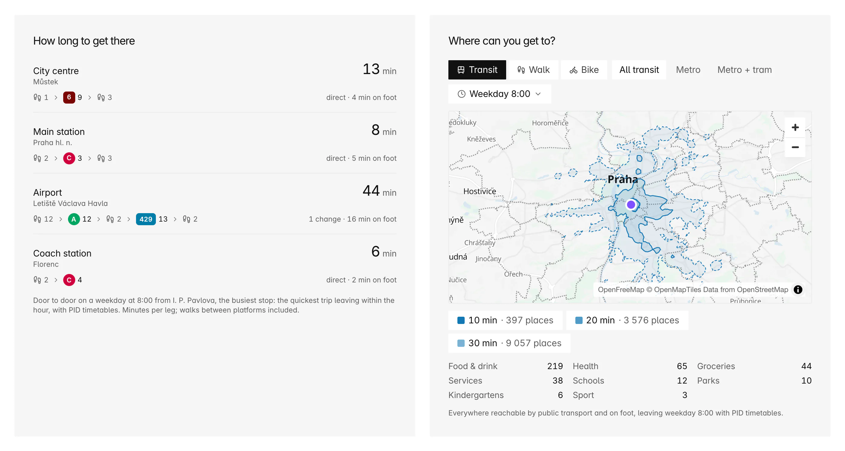
- On every area page in the PID area, from the area's busiest stop, beside door-to-door times to the centre, the main station and the airport.
- From an AI assistant connected to Bytky, which can ask the same question in plain language.
How quickly does it load?
At once for the default. The weekday 8:00 public transport bands are worked out in advance for every place with a live listing in the PID area. Any other choice is computed when you ask, in one to three seconds, and kept for the next person who asks about the same spot.
Coverage and limits
Where does it work, and where does it stop?
The reach map covers the same network as the commute filter.
- Prague and Central Bohemia only. Outside the PID area the map says so instead of drawing bands.
- Timetabled journeys, not live ones: delays, closures and replacement buses aren't in them.
- Walking and cycling follow OpenStreetMap's streets and paths at a steady pace.
- Bands start from a small cell around the point rather than the exact doorstep, so flats a few doors apart share them.
- Place counts come from open data, which can miss a new shop or still list a closed one.
- The router is rebuilt when PID publishes new timetables, and at least once a week.
Timetables: PID (ROPID), CC BY 4.0 · Map data and places: © OpenStreetMap contributors (ODbL) · Schools: Rejstřík škol © MŠMT · Health providers: NRPZS © ÚZIS ČR, CC BY 4.0 · Routing: OpenTripPlanner
FAQ
Frequent questions
More about Bytky as a whole, from what it costs to where the data comes from.
Read the main FAQWhat is an isochrone?
A line joining every point you can reach in the same time from a starting point. Bytky draws three of them, for 10, 20 and 30 minutes, so you can see at a glance how far a flat puts you from everything else.
Does the reach map include waiting for the tram?
Yes. Journeys leave at the time you pick and follow the real timetable, so the wait at the stop and at any change counts towards the 10, 20 or 30 minutes.
Why is the 30-minute band patchy?
Because public transport reaches places in jumps. A metro ride covers several kilometres in minutes and then you walk from the station, so the far band forms islands around stations, with gaps between them that take longer to reach.
Can I see reach outside Prague?
Across Central Bohemia, yes, as far as the PID network goes. Elsewhere in Czechia Bytky's router has no timetables yet, so the map shows no bands.
Is the reach map the same as the commute filter?
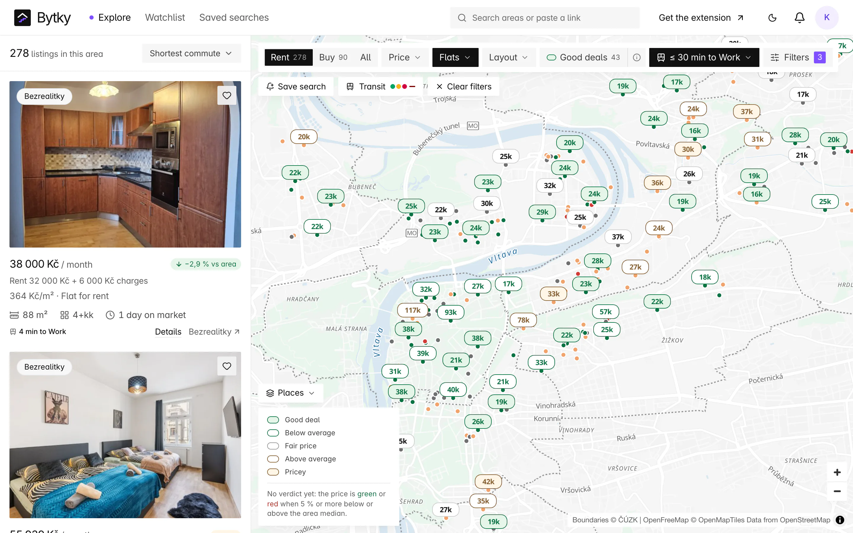
No. The reach map leaves from one flat and shows everywhere you can get to. The commute filter arrives at one place you choose and times every listing to it, so you can filter and sort the map by the trip.
Related features
Where to go next

Know what a flat is worth before you call.
Free for flat hunters. No install and no account to start.